Weather
Weekend Warmup: Snow Saturday, Sunday Before Temps Rise
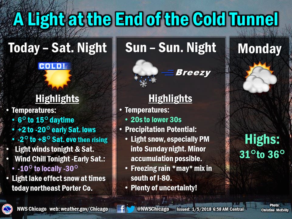
Expect temperatures to stay frigid on Friday and most of Saturday before a reprieve from the deep freeze.


Illinois started the new year with bone-chilling temperatures and wind chills of minus 20 and lower. But even as the East Coast continues to get smacked by the so-cold "bomb cyclone" that has dumped more than a foot of snow in areas and canceled flights, northern Illinois could soon see a warmup. First, though, we'll likely get some snow and possibly some freezing rain.
The long stretch of cold could mark a milestone if it continues through Saturday. If that happens, "it will mark 12 consecutive days of below 20 degrees, tying a record of such a stretch for the city (only seen twice before in the winters of 1936 and 1895)," according to the National Weather Service. In 1963, Chicago nearly had a 13-day stretch of similar cold, but one day had a high above 20 degrees.
New Year's Day was also the coldest on record in recent history.
Find out what's happening in Plainfieldwith free, real-time updates from Patch.
"The remarkably long stretch of bitterly cold weather will finally be coming to an end on Sunday, possibly accompanied by some wintry precipitation," the National Weather Service said. "This includes light snow, with minor accumulations possible, as well as the potential for freezing rain mixing in south of I-80."
Friday night and early Saturday could see wind chills of minus 10 to minus 30,
Find out what's happening in Plainfieldwith free, real-time updates from Patch.
On Sunday, temperatures could soar into the lower 30s, but expect light snow in the afternoon into Sunday night with minor accumulation possible and freezing rain south of I-80.
The work week will start with highs in the mid-30s.
Related: 17 Inches Of Snow For Parts Of Massachusetts
Here's a look at the forecast for the weekend heading into Monday for Chicagoland:
Saturday January 6
Mostly cloudy overnight. High 13, low -0.
Chance of precipitation: 13%. Wind 5 mph from the WNW
Sunday January 7
Foggy starting in the evening. High 29, low 3.
Chance of precipitation: 34%. Wind 15 mph from the SSW
Monday January 8
Foggy in the morning. High 29, low 25.
Chance of precipitation: 25%. Wind 9 mph from the WSW
Get more local news delivered straight to your inbox. Sign up for free Patch newsletters and alerts.