
GRAND FORKS — Though weather predictions are still uncertain, meteorologists say things could get bad this week — bad enough for the Red River Valley to see a blizzard in October.
Rain is predicted to hit the night of Wednesday, Oct. 9, and turn into snow as the storm system moves from west to east across the region.
National Weather Service meteorologist John Hoppes said Grand Forks could see about a quarter-to-half inch of rain before the snow begins, but areas in northwestern Minnesota may get half-to-three-quarters inch of rain.
Hoppes said there could be up to 8 to 10 inches of snow in Grand Forks and areas west of Hallock. It’s still unclear where the snowfall will hit hardest.
Heavy winds are expected to hit the region Thursday afternoon into Saturday, Hoppes said. The potentially 40 mph or higher gusts paired with falling snow could cause blizzard-like conditions, he said.
ADVERTISEMENT
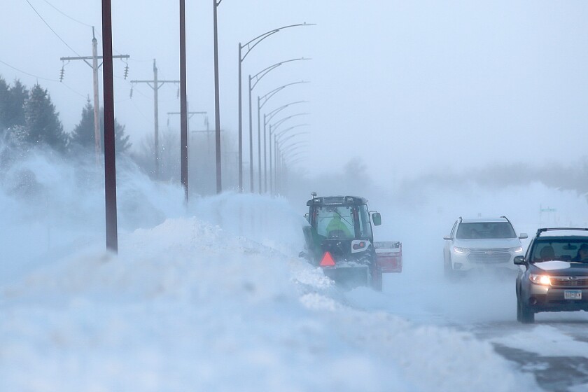
Driving will likely be challenging, as visibility could be decreased and roadways will likely be slushy, the weather service said. Conditions are expected to be at their worst Friday and Saturday. Hoppes warned that there are usually more traffic accidents during the first storm of the year, even in tamer storms.
“They’ve just got to be careful driving out there because we’re not used to it yet,” he said.
The weather service warned that trees are more susceptible to damage because many still have their leaves, which could cause them to become more overloaded and heavier with snow and snap. Power outages also are possible.
Hoppes said it’s likely unusual for such a strong snowstorm to hit so early in the year, but noted that North Dakota has historically seen snow at some point during nearly every month.
An Oct. 10 storm last year dropped 5.7 inches of snow on Grand Forks and 19.2 inches at the Air Force base.
ADVERTISEMENT

Temperatures next week are expected to remain in the 30s, which could mean the snow may stick around into the week, depending on how much the region sees, Hoppes said.
There was 8.14 inches of rain last month, breaking Grand Forks’ historic monthly total. The area is in a flood warning and the weather service predicts the Red River will crest at 34.5 feet Wednesday. Hoppes said the extra rain and snow that is expected to fall this week could exacerbate the potential for flooding in the spring.
“If we go into a freeze from here, now that’s just going to lock it into the soil,” Hoppes said. “And then when spring comes, whatever melts will be more likely just to run right off because it’s got nothing to soak into.”


