Weather
Big Warmup For Illinois, Snow Possible
After the coldest Valentine's Day in nearly 80 years, we should see a warmup — and then possibly more snow.

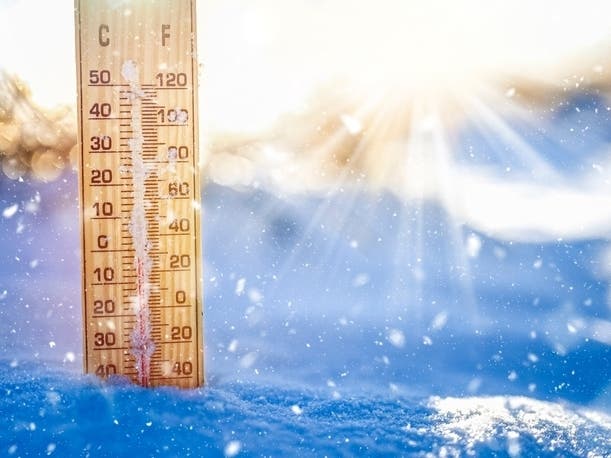
ILLINOIS — After the coldest Valentine's Day temps since 1943, temperatures should rise back up to the 30s this weekend. There is also a chance of snow Saturday and late Sunday night, the National Weather Service said.
Friday morning saw temperatures drop below zero in several areas. It was 7 below zero in Romeoville; 2 below zero at O'Hare; 1 below zero at Midway; and it was coldest in South Beloit which was 19 below zero.
Saturday has a high of 36 degrees, although it is expected to be windy Saturday morning, the weather service said. Sunday will be similar, with a high of 39 degrees, and it will be partly sunny. There is a chance of snow late Sunday into Monday, which will have even warmer temps up to 44 degrees.
Find out what's happening in Lemontwith free, real-time updates from Patch.
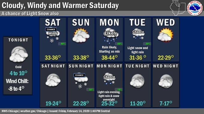
Here is a more detailed look at the weather this weekend:
FRIDAY NIGHT: Increasing clouds, with a temperature rising to around 15 by 5 a.m. Wind chill values as low as -7. South wind 5 to 15 mph, with gusts as high as 25 mph.
Find out what's happening in Lemontwith free, real-time updates from Patch.
SATURDAY: A 50 percent chance of snow after noon. Cloudy, with a high near 33. Wind chill values as low as 1. Breezy, with a south southwest wind 15 to 20 mph, with gusts as high as 30 mph.
SATURDAY NIGHT: Mostly cloudy, with a low around 22. Southwest wind 5 to 15 mph, with gusts as high as 25 mph.
SUNDAY: Partly sunny, with a high near 35. Calm wind becoming west southwest around 5 mph.
SUNDAY NIGHT: A 50 percent chance of snow after midnight. Mostly cloudy, with a low around 25.
Get more local news delivered straight to your inbox. Sign up for free Patch newsletters and alerts.