Clipper system bringing snow, ice and cold to entire eastern US
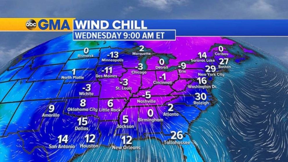
A big chill is on the way after the storms move through.
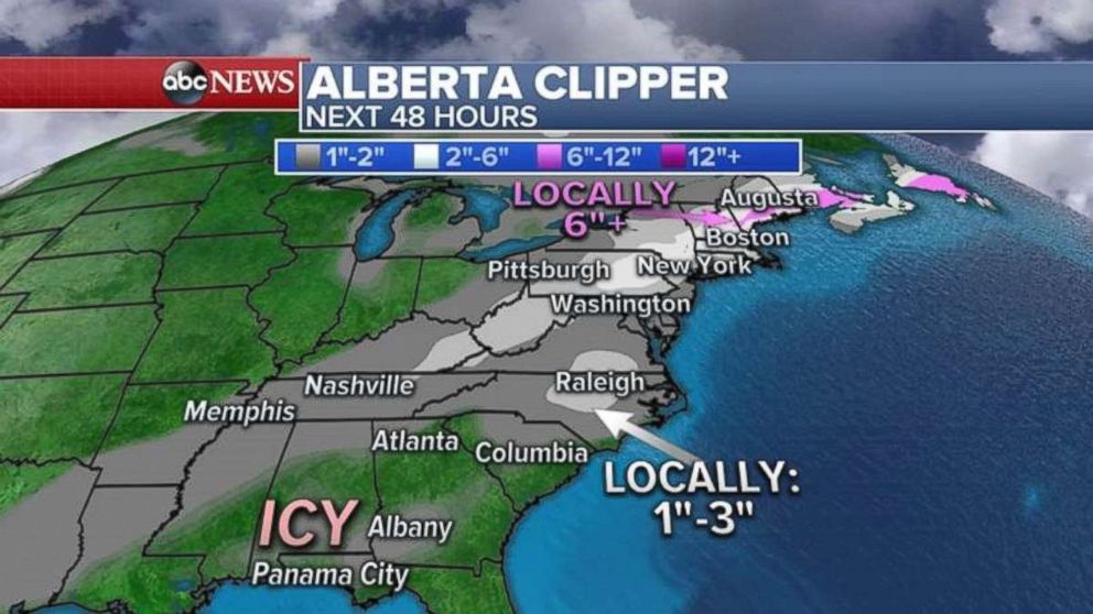
— -- An Alberta Clipper -- and cold front associated with it -- continues to move through the eastern U.S. from the Midwest through the South and eventually into the Northeast late Tuesday into Wednesday.
Up to 18 inches of snow fell in parts of Wisconsin yesterday while Chicago got up to 2.3 inches, the most snow so far this season in the Windy City.
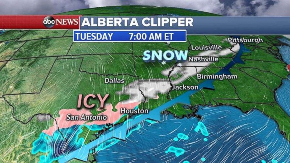
Numerous accidents were reported as the snow moved through the Dallas-Fort Worth area overnight. Snow fell in Memphis and Nashville on Tuesday morning, where accidents were likely on the slick roads.
Alerts were in place for practically the entire United States east of the Rockies.
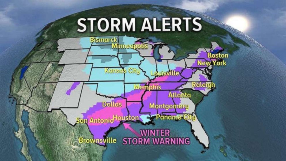
Most of the concern Tuesday morning is in the Deep South and the Gulf Coast where numerous winter storm warnings and winter weather advisories have been issued for ice and snow.
Many cities from Texas to Alabama have closed or delayed schools today.
The snow and ice moves into the Southeast and panhandle of Florida on Tuesday night and will reach all the way up the coast into the Washington, D.C. and Boston area.
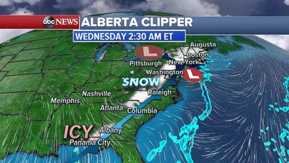
Snow will be flying Wednesday late morning from Florida to Maine. A rare winter weather advisory has even been issued for Panama City, Florida.
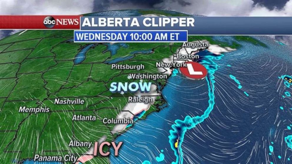
The heaviest snow will be found in the Northeast over the next 24 to 36 hours, where some areas could see more than a half a foot of snow.
Behind the storm system, cold air spills all the way to the Gulf Coast as wind chills on Wednesday morning will dip into the single-digits as far south as Amarillo, Texas and Jackson, Mississippi.
Related Topics
