

Environment Canada has ended a blowing snow advisory for Saskatoon and the surrounding area, along with the Battlefords, Kindersley, Rosetown, Watrous and Outlook for poor visibility in snow and blowing snow.

Strong gusty winds combined with heavy snow reduced visibility below 800 metres for hours on Friday before conditions improved during the afternoon.
Kindersley was at less than 400 metres of visibility for three hours during the morning and the Saskatchewan Highway Hotline reported poor visibility on many highways.
Winter storm and snowfall warnings were also in effect in parts of southern southern Saskatchewan for 10 centimetres of snow and poor travel conditions.
Motorists planning to head out on roads are advised to use caution and check in with Saskatchewan Highway Hotline before heading out.
For the latest weather alerts download the Global News SkyTracker Weather App for iPhone, iPad or Android.
WATCH: Complaints raised about inaccessibility to Saskatoon streets

Saskatoon Forecast
Friday
Snow falling with winds around 40 to 50 km/h with gusts upwards of 60 km/h dropped visibility to as low as 600 metres in Saskatoon on Friday morning as a system ploughed through the region.
Temperatures sat around -2 all morning, but because of the powerful wind, it felt like -10 with wind chill as treacherous road conditions prompted the city and Saskatoon police to ask drivers to use extra caution.
Snow remained steady and heavy at times through the afternoon, keeping visibility reduced as winds continued gusting upwards of 60 km/h before snow started to ease later on with temperatures staying just shy of the freezing mark.
Friday Night
Snow and wind will ease right off Friday evening with clouds starting to clear overnight as we cool back toward minus double digits.
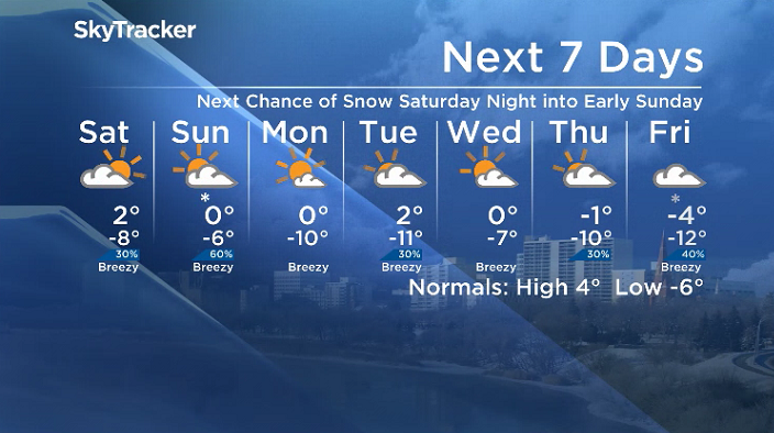
Saturday
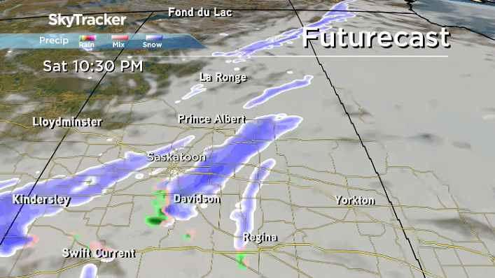
-15 is around what it’ll feel like with wind chill to start the weekend with some sunshine to start the day before clouds roll back in later on with the next system that may bring in some snow Saturday night into early Sunday.
Winds will be a bit breezy in the afternoon, with gusts upwards of 30 to 40 km/h possible as we warm up to an afternoon high around or just above the freezing mark.
Sunday
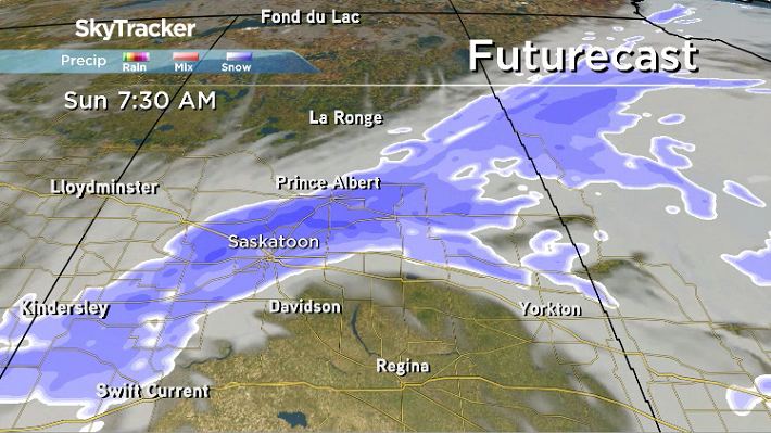
Early morning snow is possible Sunday morning before the system starts to slide off to the northeast and we get into some sunshine later in the day.


Temperatures are expected to remain slightly cooler on Sunday with the mercury struggling to get up to the freezing mark for an afternoon high.
Work Week Outlook
Some sunshine will start off the work week with cool, minus double digit mornings Monday and Tuesday with wind chills approaching the -20s, but we push up toward the freezing mark later on with clouds rolling in mid-week.
Brenda Gawluk took the March 23 Your Saskatchewan photo in Kandahar:

Saskatoon weather outlook is your source for Saskatoon’s most accurate forecast and is your one stop shop for all things weather for central and northern Saskatchewan with comprehensive, in depth analysis that you can only find here.
- Life in the forest: How Stanley Park’s longest resident survived a changing landscape
- Bird flu risk to humans an ‘enormous concern,’ WHO says. Here’s what to know
- Roll Up To Win? Tim Hortons says $55K boat win email was ‘human error’
- Election interference worse than government admits, rights coalition says
Comments