
Remembrance Day long weekend was dominated by a mix of sun and cloud throughout the region with daytime highs making it into mid-single digits.

Mostly cloudy skies with some valley cloud lingered into Holiday Monday with temperatures slipping below freezing by a few degrees and wind chills as cool as -9 in Vernon to start the day.
A ridge of high pressure is trapping wood smoke and pollutants from industry and transportation in the area in Lavington, prompting a special air quality statement to be issued for the area, reminding people to avoid outdoor activity if having difficulty breathing.
Clearing skies during the day will propel thermometers up to around 6 degrees for an afternoon high for the third day in a row.
More valley cloud will develop Monday night into Tuesday morning under a ridge of high pressure that is slowly sliding east over the area.

Higher clouds will also roll in to start the day with temperatures a few degrees below freezing, but a strong system pushing into the North Coast will kick up a gusty southwesterly wind during the day.
That wind will help temperatures swing up to around 6 or 7 degrees in the afternoon as midday sunny breaks roll in before the next wave of clouds returns during the evening.
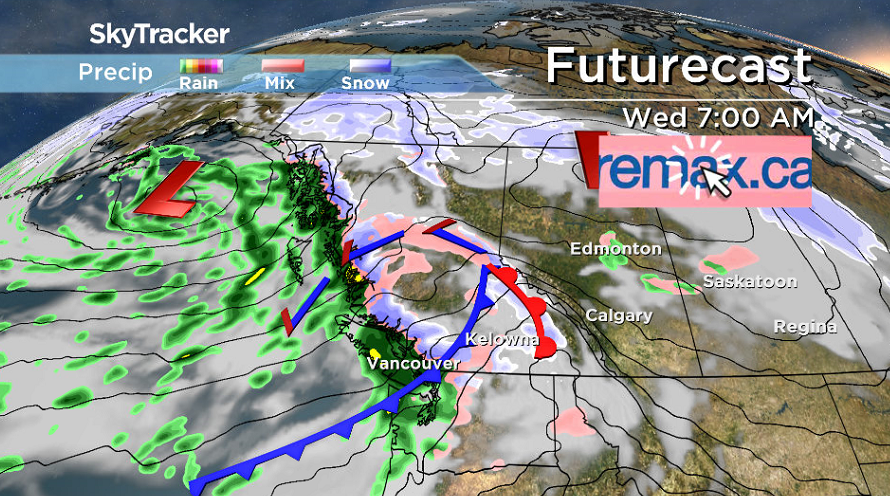
There is a chance of some wet valley snow early Wednesday morning with a front swinging through, but they will change over to rain during the day if they even fall as snow at all.


Showers can be expected off and on at times during the day before the next round of rain rolls in on Thursday, a system swinging in before precipitation and eventually the clouds clear on Friday.
Daytime highs will stay in mid-single digits for the rest of the week.
A mix of sun and cloud is slated to stick around for the weekend ahead with morning lows a touch below freezing and afternoon highs hopping back into mid-single digits.

For weather on the go download the Global News SkyTracker Weather App for iPhone, iPad or Android.
Comments