

Flurries for the final day of winter, snowstorm expected in the first few days of spring.

Saskatoon Forecast
Monday
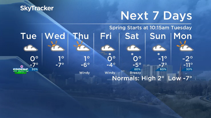
Winter is finishing off on a fitting note with the final full day of the season starting out with light snow falling in the city.
-14 is what it felt like with wind chill to start the day as temperatures dipped back to -8 before warming into mid-minus single digits by noon under cloudy skies and light snow at times through the morning.
Pockets of snow stuck around during the afternoon as we rose up to a daytime high 2 degrees shy of the freezing mark.
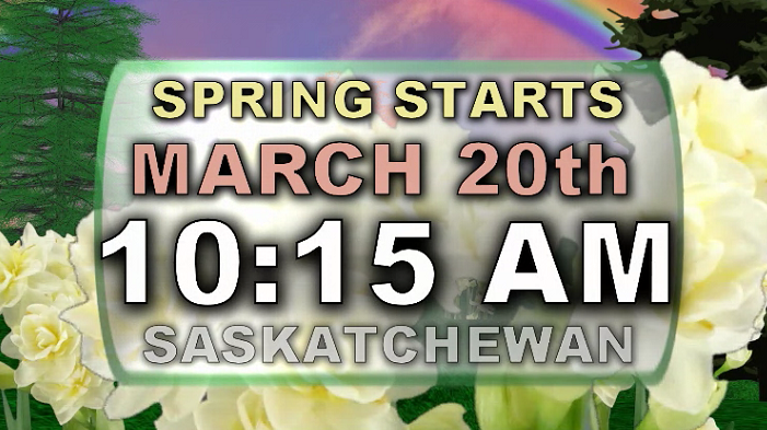
First Day of Spring (Tuesday)
Spring officially starts at 10:15 a.m. Saskatchewan time with wind chills dipping back into minus double digits in the morning before the mercury kicks up toward the freezing mark for an afternoon high.
Cloudy skies will continue throughout the day with a chance of early morning flurries and a better chance of late day and evening snow as a trough pushes through.

Wednesday-Friday
Our best chance of a few sunny breaks are on Wednesday and Thursday, although models are keeping skies cloudier than initially anticipated, so we may not see any at all.
Daytime highs should manage to make it up to and likely above freezing for the first three days of spring, however on Friday a system with heavy snow and strong wind is expected to hit the area.
At this point, it appears that five to 10 centimetres of snow with wind gusts in excess of 60 km/h is possible, however those amounts could be even higher – so we will continue to refine the forecast as the date approaches.
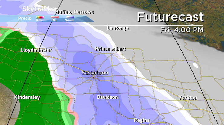

All major models are suggesting a significant snow event, so certainty with this occurring is higher and the potential for it to be a hazardous day due to strong winds is also high, which means visibility and road conditions are likely to be poor at times in some areas.
Weekend Outlook
Most models are holding us in the snow zone for the rest of the weekend with lesser amounts expected on Saturday and just light flurries possible Sunday with afternoon highs around or just shy of the freezing mark.
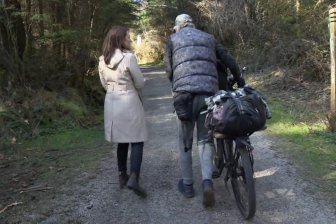
The March 19 Your Saskatchewan photo was taken near Bradwell by Katheryn Sepke:

Saskatoon weather outlook is your source for Saskatoon’s most accurate forecast and is your one stop shop for all things weather for central and northern Saskatchewan with comprehensive, in depth analysis that you can only find here.
Comments