
After a cold, snowy week with 22 centimetres now reported on the ground in Kelowna, 57 centimetres in Salmon Arm and temperatures toward the -20s, relief is on the way before more flurries filter in.

Light snow started the day on Thursday, with a snowfall warning for 10 to 15 centimetres in the South Okanagan.
Temperatures began in the minus teens, though the first minus single digits of the workweek should slide in during the afternoon.
Snow will start to slow and slide out of the area on Thursday night, with clouds finally starting to clear out overnight as well, resulting in the mercury dipping back into the mid-minus teens overnight.
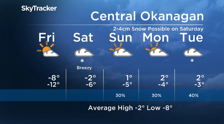
It’ll feel close to -20 as you’re heading out the door Friday morning with the wind chill, but sunny breaks during the day will help warm the valley back into minus single digits.
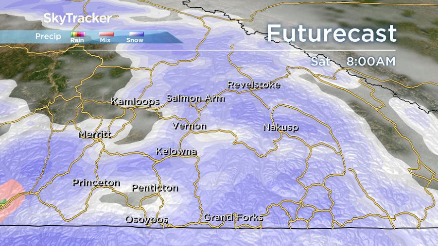
Clouds will quickly filter back in during the evening followed by snow Friday night into early Saturday.
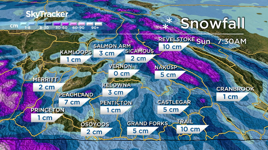
Expect some fresh powder at local ski areas on Saturday, with light snow falling in the valley bottom as well, with expected totals of 2 to 4 centimetres by the end of the day when it eases.


Temperatures will rise close to the freezing mark on Saturday before likely surging above it by a degree or so on Sunday under mostly cloudy skies, with a chance of flurries at higher elevation areas.
Clouds will linger into next week with a chance of a few more flurries on Tuesday, as daytime highs hover just above the freezing mark and overnight lows just below zero.
For weather on the go download the Global News SkyTracker Weather App for iPhone, iPad or Android.
Comments